The Zealandia Timescale
The timing and rates of change of environmental response to past extreme climate events, earthquakes, or volcanic eruptions, will ultimately help to predict future trends. Oceans are critical to understanding how these geological processes operated in the past and how they may operate in the future.


Background
Climate change is delivering ocean heatwaves, sea-level rise, coastal erosion and more frequent extreme weather events. To understand these impacts, GNS scientists need more information about the past and its many warmer-than-present periods.
Geologists first coined the term Zealandia - or Te Riu-a-Māui- in the mid-1990s for what they saw as the Earth’s eighth continent. Te Riu-a-Māui literally means the hills, valleys and plains of Māui - the great East Polynesian ancestor who explored the Pacific Ocean.
GNS Science runs numerous ocean research programmes to deliver new understanding about tectonic and volcanic evolution, sedimentary basin and paleogeographic setting, marine and terrestrial biology, and past and present surface geological processes.
Project details
GNS’ research focuses on specific past time periods that represent conditions similar to possible future climate scenarios. This will help assess the rate of warming Aotearoa New Zealand is experiencing and how that appears in the climate system. It will also help determine the broad environmental response to small-scale climate change.
Each project contributes to the New Zealand Geological Timescale.
Aotearoa New Zealand Timescale poster (PDF. 50.75 kB)
Global chronological timescale (PDF. 163.03 kB)
New data, wider assessment of Zealandia ocean drilling legacy records, collaboration and better analysis means GNS can reduce uncertainty around past climate events. This will also help meet an increasing need to have integrated environmental responses.
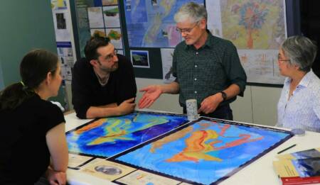
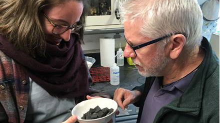
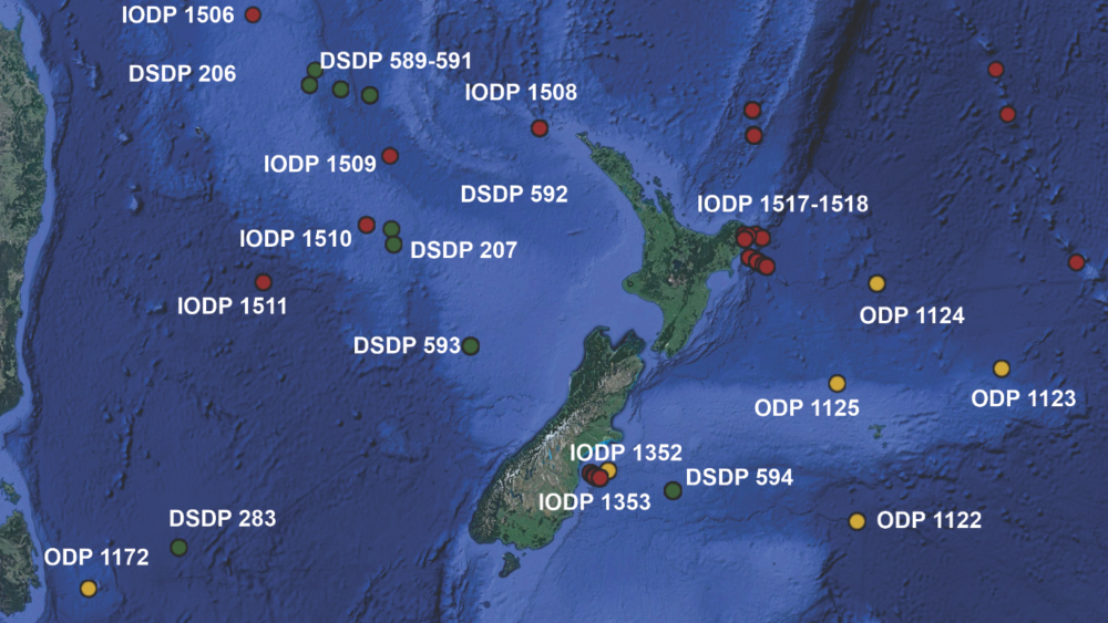
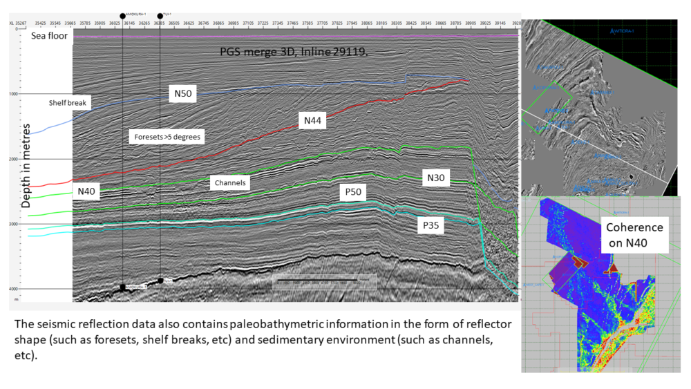
The images show how the story in the sediments is unravelled onboard the Joides Resolution: Rosie Sheward (Micropaleontologist, Goethe University Frankfurt, Germany) and Chris Hollis (Observer/Micropaleontologist, GNS Science), discuss sample processing in the paleontology lab (Credit: Lindy Newman & IODP). They also show locations of ocean floor drilling expeditions and how scientists are able to map the complex layers that show the changes in geological setting through time by using deep sea drilling data and seismic images of the basins.
What they hope to achieve
This study will identify key pre-cursor events to a 2⁰C warming trend. The challenge is to determine when the Earth will be 2⁰C warmer than pre-industrial levels. However, given the current level of greenhouse gas emissions, it is very likely this threshold will be exceeded in the next few decades.
These changes will lead to a new geographical distribution of kai moana / seafood and kai whenua / agriculture. The study will incorporate mātauranga Māori to help understand the effects of warming on sustainable practises.
Work in the GNS Zealandia Programme is a test case for applying statistical analysis to the constraints that define the time-model. The next stage will involve geophysically mapped seismic time-horizons and fine-scale cycles driven by Earth’s orbital patterns.
Citizen science opportunities
Geotrips offers experiences with past geological processes and environments. Virtual geotrips are also being created for remote or inaccessible areas. Visit Geotrips.
The International Ocean Discovery Program (IODP) includes open days on research vessels during port calls, and ship-to- shore links for schools and community groups. Visit IODP.
Resource