A reliable ocean forecast tool for managing marine disasters in Aotearoa New Zealand
This three-year programme aims to develop an Aotearoa New Zealand-specific ocean forecast tool to provide better disaster preparedness. Data from below the ocean’s surface is being incorporated into existing ocean modelling capabilities to develop and provide real-time ocean forecasts.


Background
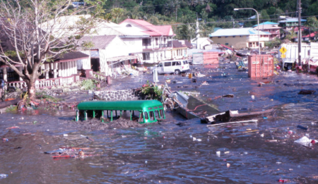
New Zealand is a nation familiar with natural disasters, such as earthquakes, and being prepared is the best way to minimise the scale and costs of a disaster. Ocean models inform us about how the ocean behaves.
Project details
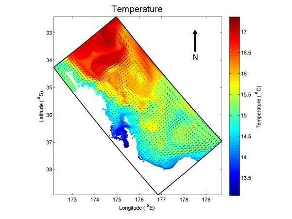
The project will extend existing capabilities in ocean modelling into a real-time ocean forecast. Providing accurate ocean forecasts that reflect reality requires surface and subsurface data to be generated and incorporated into the models in near-real-time.
What they hope to achieve
Ocean weather is one of the big unknowns in understanding how the ocean transports and disperses materials such as pollutants or sediments. To overcome this unknown, the team will:
- develop new technical skills of data assimilation and ocean forecasting
- resolve ocean weather dynamics in real-time from ocean gliders.
Having a more accurate ocean forecast tool will help ensure that New Zealand has the capability to respond quickly to any future marine disaster. The benefits of a data-assimilating ocean forecast extend well beyond marine disaster scenarios.


Resource